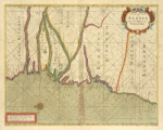
A chart of coast of ANGOLA from R Ambris to Mount Negro
View
@ Lionel Pincus and Princess Firyal Map Division. The New York Public Library

Thornton, Samuel
Description
Contains 8 pages of text and 173 double-page large folio charts, colored by a contemporary hand.Most of the maps bear the imprint of Samuel Thornton, but some were issued by John Thornton, and others. The volumes may be a compilation from several sources, including John Thornton's Atlas maritimus.--cf. Bookseller's description inserted in v. 1; Sabin 95631; and Phillips 2833, 3455.
1702 1707


![Preliminary chart of St. John's River, Florida : from entrance to Brown's Creek / [published by] U.S. Coast and Gedoetic Survey ; triangulation by Lieut. A.W. Evans, U.S.A. & G.A. Fairfield, Assts. ; topography by A.M. Harrison, Asst. & R.M. Bache, Sub-Asst. ; hydrography by the parties under the command of Lieuts. Comdg. T.A. Craven & R. Wainwright, U.S. Navy Assistants ; A.D. Bache, Superintendent [in 1856] ; C.P. Patterson, Superintendent [in 1879] ; J.E. Hilgard, Assistant in charge of office ; redd. drng. by A. Balbach & W. P. Schultz ; engd. by H.S. Barnard & A. Petersen](https://d2l9jrtx1kk04i.cloudfront.net/1220eac852e129ade7853c9695d48d8a2276d15a.png "Preliminary chart of St. John's River, Florida : from entrance to Brown's Creek / [published by] U.S. Coast and Gedoetic Survey ; triangulation by Lieut. A.W. Evans, U.S.A. & G.A. Fairfield, Assts. ; topography by A.M. Harrison, Asst. & R.M. Bache, Sub-Asst. ; hydrography by the parties under the command of Lieuts. Comdg. T.A. Craven & R. Wainwright, U.S. Navy Assistants ; A.D. Bache, Superintendent [in 1856] ; C.P. Patterson, Superintendent [in 1879] ; J.E. Hilgard, Assistant in charge of office ; redd. drng. by A. Balbach & W. P. Schultz ; engd. by H.S. Barnard & A. Petersen")


