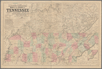
Lloyd's new county map of the United States and Canadas showing battle fields, railroads, &c., compiled from the latest government surveys & other reliable & official sources
View
@ Lionel Pincus and Princess Firyal Map Division. The New York Public Library
Schönberg & Co
Description
Relief shown by hachures.For Canada, covers southern Quebec and Ontario.Description derived from published bibliography.Includes table of population and inset extensions for southern Florida and "California, Oregon and the territories.Indicates location and date of engagements, towns, railroads, state and county boundaries, and rivers.
Text
Maps
H.H. Lloyd & Co
1863
From Collection
Maps of North AmericaRecord Contributed By
Lionel Pincus and Princess Firyal Map Division. The New York Public LibraryRecord Harvested From
The New York Public LibraryKeywords
- American Civil War (1861 1865)
- Civil War
- Civil War, 1861 1865
- History
- Ontario
- Railroads
- United States


