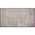
A Division Plat of [the] Lands of [Joseph Ennett] agreeable to order of Court from Novr. term 1818
View
@ University of North Carolina at Chapel Hill
Simmons, Everitt
Description
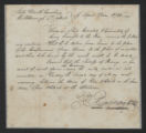
Hand-colored manuscript, mounted. This is the map of a survey by Everitt Simmons, county surveyor of Onslow County, of the division of the lands of Joseph Ennett's estate among his heirs. The map shows the boundaries of each tract, adjacent landowners, and waterways and other landmarks. The name of the individual to whom each tract is assigned, the acreage of the tract, and its appraised value are reported on the face of the map and also listed in the upper right hand corner.Jacob Golden, Daniel Nixon, Nathaniel Stanly, Charles Snead, and W. L. Hill were appointed commissioners by the Onslow County Court of Pleas and Quarter Sessions at the November Term 1818 to appraise and divide the land among the heirs.This map was formerly classified as M.C. 80-H.
Image
Maps
This item is presented courtesy of the State Archives of North Carolina, for research and educational purposes. Prior permission from the State Archives is required for any commercial use.
![Thumbnail for A Division Plat of [the] Lands of [Joseph Ennett] agreeable to order of Court from Novr. term 1818](https://d2l9jrtx1kk04i.cloudfront.net/4f9b75f44f8b66d14a0d7020f5460ee0a58b993c.png)


