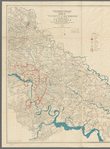
Middle Virginia and North Carolina
View
@ Lionel Pincus and Princess Firyal Map Division. The New York Public Library
Krebs, Charles G
Description
Shows cities and towns, roads and railroads, and rivers; overprinted in red to highlight state boundaries and railroads. Relief shown by shading.
Text
Maps
United States Coast SurveyLindenkohl, H. (Henry)
1861
From Collection
Maps of North AmericaRecord Contributed By
Lionel Pincus and Princess Firyal Map Division. The New York Public LibraryRecord Harvested From
The New York Public LibraryKeywords
- American Civil War (1861 1865)
- Civil War
- Civil War, 1861 1865
- History
- North Carolina
- United States
- Virginia


